Analyzing phenomena related to livability and perception of urban safety at night along the banks of the Dora river is the objective of the Urban Data Platform developed within the ToNite project.
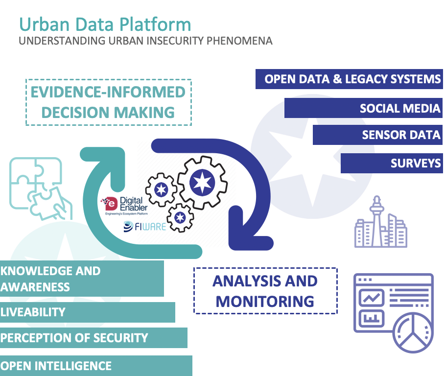
By integrating, aggregating and visualizing heterogeneous data from the City, related to the urban security context, the platform provides a comprehensive, rather than sectorial, view of urban phenomena, improving the City’s decision-makers’ ability to monitor implemented interventions, assess impacts, detect the emergence of new phenomena, understand community needs and plan future actions.
The Urban Data Platform presents itself as an innovative and operational tool available to the public administration to support the definition of governance policies for the territory and public space management.
The project partner Engineering Ingegneria Informatica Spa, starting with its IoE FIWARE-based Digital Enabler platform, implemented the main components constituting the three layers which characterize ToNite’s Urban Data Platform.
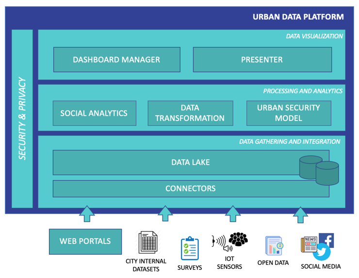
1 – Data layer
This is the layer that collects, integrates and harmonizes static, dynamic, structured and unstructured data from heterogeneous sources (Open Data and legacy systems, geoportals, sensors, social media, surveys) made available by the City of Turin and the territory.
For some datasets identified as useful for the purposes of the project, for which no data access interfaces were found, the need emerged to create ad hoc software components to extract and import data in an automated way.
2 – Processing and analysis level
This level processes and correlates data according to useful models to support the interpretation of phenomena, the analysis of possible evolutions of what is happening, and the planning of interventions.
In particular, the platform integrates the Urban Security Data Model, which represents the starting model for calculating the security perception index. The model implemented in the platform makes it possible to analyze the dimensions related to livability and perceived security in the areas under investigation, exploiting the integrated data.
The model examines the concept of safety and livability not only on the basis of objective data relating to crimes and offences, but also on the basis of subjective data that consider the lives and experiences of the population in the survey areas along the Dora.
The theoretical model was based on the outcome of ethnographic and social research and a review of the literature on the perception of safety. The themes that emerged from the qualitative research were reworked and reformulated for the model to reflect the dimensions and structure of the phenomenon under study.
The output of the model is a composite indicator (the result of which is an index), thanks to which the evolution of the phenomenon over time can be understood, becoming a useful tool to support policy decisions.
If on the one hand the model offers the possibility of visualizing and analyzing data on perceived safety and livability, on the other its implementation in the platform favors the adoption of a shared and collaborative approach in which the data support intra- and inter-departmental decisions of the City of Turin, beyond the themes of urban regeneration. The model was built based on the local context of Turin, specifically in the project’s survey areas; in the future it is intended to be extended to the whole city.
3 – Dashboard creation and visualization level
The data visualization level monitors and analyses the dimensions that characterize the perception of safety and livability of the Lungo Dora areas, through the creation and visualization of customized dashboards consisting of maps, graphs and time series.
Thanks to direct contacts with various stakeholders of the city interested in the data visualization and analysis potential offered by the Urban Data Platform, through a continuous process of interaction, collaboration, feedback, verification and validation, it was possible to build several dashboards for the City’s operators able to monitor phenomena related to the perception of urban insecurity and support decision-making and operational processes.


